

RSVP required to niches@nicheslandtrust.org or call 765-423-1605, unless otherwise noted.
All times eastern daylight savings time.
Project Native Harvest: Weiler-Leopold
Description
Project Native Harvest
2026 Volunteer Seed Collection Series
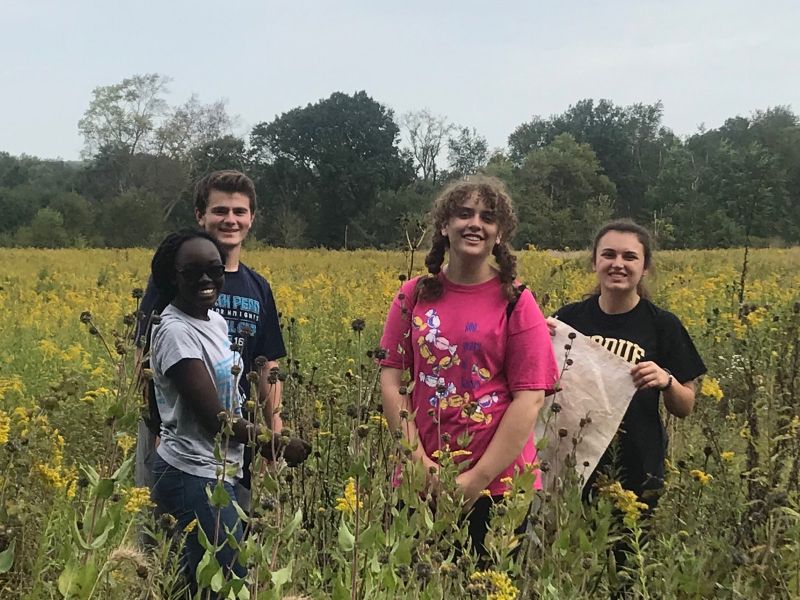
Join us for 'Project Native Harvest' our 2026 volunteer seed collection series! As NICHES staff and volunteers restore habitats and remove invasive plant species from our preserves, we can help reduce reinvasion and rebuild biodiversity by collecting locally sourced native seeds for habitat restoration. For this year’s effort, we will be hosting seed collection workdays every Friday (1-4pm) between July 31st and October 23rd at local nature preserves within a 10–50-minute drive of Lafayette.
Registration is preferred. Sign up for this and other shifts here>>>
What to bring: Please dress for the weather and wear sturdy footwear suitable for working outdoors. Since we'll be venturing off trail to collect native seeds, long pants and long sleeves are strongly recommended for protection from tall vegetation, insects, and poison ivy. We also recommend bringing sunscreen, insect repellent, work gloves, snacks, and plenty of water.
Where to meet: Weiler-Leopold Nature Reserve
From Lafayette/West Lafayette take South River Road/Division Road west across US 231 and follow that for 8.3 miles to the Ravines Golf Course at S 875 W and take a left. Follow S 875 W past Ross Hills Park and curve right onto W 50 S. Take the next left onto 925 W and follow that past Ross Camp and curve right onto W 75 S. Take the next left onto S 950 W and follow that across the Tippecanoe/Warren County line. When you cross into Warren County S 950 W becomes E 350 N. At the next intersection with N 1100 E take a left and follow the road for 0.7 miles, around the next curve. The shared parking lot for Black Rock Barrens and Weiler-Leopold will be on your left a short distance after you round the curve.
From Attica/Williamsport turn onto SR 55 from SR 28/41 and cross the bridge over Big Pine Creek. Take the first right onto E Independence Road. Follow Independence Road for 8.8 miles. The parking area for Black Rock Barrens, Weiler-Leopold, and Kohnke’s Little Pine Creek will be on your right.
The coordinates for the parking lot are: N 40° 21.542′ – W 87° 06.968′.
Note: Seasonal timing and seed availability can be hard to predict. Some workday locations and target species may change as we get a better idea of what is available and where volunteer support is most needed. Participants will be notified by email of any location changes immediately!
Full Schedule:
|
Date |
Location |
Primary Target |
|
7/31 |
Granville Sand Barrens |
Early wild rye (Elymus Macgregorii) |
|
8/7 |
Shawnee Bottoms |
Silky wild rye (Elymus villosus) |
|
8/14 |
Shawnee Bottoms |
Beardtongue (Penstemon) |
|
8/21 |
Granville Sand Barrens |
Virginia wild rye (Elymus virginiana) |
|
8/28 |
Granville Sand Barrens |
Sand sedge (Carex muehlenbergii) |
|
9/4 |
Frogs’ Glory |
Beak grass and wild rye (Diarrhena and Elymus) |
|
9/11 |
Granville Sand Barrens |
Flowering spurge (Euphorbia corollata) |
|
9/18 |
Weiler Leopold |
Beak grass (Diarrhena spp.) |
|
9/25 |
Farris Estate |
Prairie rose (Rosa carolina) |
|
10/2 |
Farris Estate |
Leadplant (Amorpha canescens) |
|
10/9 |
Shawnee Bottoms |
Woodreed (Cinna spp.) |
|
10/16 |
Echo Valley |
Purple false foxglove (Agalinis purpurea) |
|
10/23 |
Granville Sand Barrens |
Prairie dropseed (Sporobolus heterolepsis) |
Location information
Shawnee Bottoms
How to Get There
From the SR 28 and US 41 intersection in Attica Take US 41 south 4.9 miles and turn right onto E 650 N. Next, turn right onto County Road 160 W/N Williamsport Road. From here, the road jogs left for 1/10 of a mile becoming County Road 700 N then jogs back right to become County Road 170 W/N Williamsport Road. In 0.5 miles turn left onto W 750 N/W Covered Bridge Road. *be aware that as of March 2016 no road sign identifies W 750 / Covered Bridge Road at the intersection with N. Williamsport Road. If you cross to the north side of the Wabash, you have missed the turn. Travel West on W Covered Bridge Road through a curve to the left and a curve back to the right. When you get to the next curve take the short lane into the parking area where you will see the large wooden “Shawnee Bottoms” sign.
1782 N 400 E, Lafayette, IN 47905
(765) 423-1605
niches@nicheslandtrust.org