Kohnkes’ Little Pine Valley
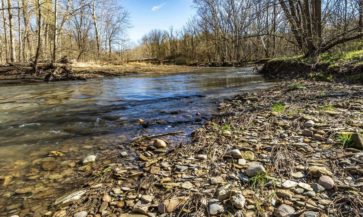
A beautiful 33 forested acres in Little Pine Creek valley, Kohnkes’ Little Pine valley sits just a short distance west of NICHES’ Weiler-Leopold Nature Reserve.
Activities
- Bird Watching
- Mushroom Harvesting Allowed
- No Trails
- Wildflowers
History of Acquisition and Property
NICHES was able to purchase this property from Doug and Judy Knudson in December 2003 thanks to the financial support from the Roy Whistler Foundation, Gerda Kohnke, Jim Ahlrichs, and the Eli Lilly Clinton Labs employee organization!
Formerly home of Helmut and Gerda Kohnke's family summer cottage, this beautiful piece of forest in Warren County came into the hands of the conservation-minded family in 1949. The Kohnke’s intent was to use it as a retreat from town, as well as a place to enjoy the sights and sounds of nature. Much of the sandy bottomland was planted in pine, fir, and spruce with the aim of selling Christmas trees.
Helmut and Gerda Kohnke built a small cabin on this land and Gerda fondly remembers her family using the swimming hole in Little Pine Creek where friends and neighbors cooled off and learned to swim. Bonfires fed by dead wood provided coals for many cookouts. The ridge above the west side of the creek was their own devil’s backbone and hikes along this ridge led to the “Grand Canyon” where icicles hung thick and long in winter. When Christmas trees matured, friends were invited out to the valley to cut their own. Those December weekends would often turn into family outings including sledding, hiking, and warming up around the woodstove in the cabin.
After Helmut passed away, Gerda developed an Audubon easement to restrict development so that future owners would maintain the property in its natural state as they had. She and her family sold Little Pine Valley in 1992.
Gerda and her children were glad that NICHES wanted to own the land and hope the property will serve as a living memorial to Helmut, an agronomist who was very active in the land conservation movement in Indiana. The few original Christmas trees that remain tower over the bottomlands providing cover for a variety of birds, mammals and reptiles. As Gerda described the waves of wildflowers that cover the steep ravines in spring, her face lit up. She continues to remember the valley as a wonderful place to sit and enjoy the sound of the gurgling creek. She says that she always wanted people to just enjoy it and is “absolutely very happy that it will be forever protected.”
In fact, it was the conversations about conservation of Konkhe’s Littke Pine Valley that was part of the original inception of NICHES Land Trust.
How to Get There
From Lafayette / West Lafayette take South River Road/Division Road west across US 231 and follow that for 8.3 miles to the Ravines Golf Course at S 875 W and take a left. Follow S 875 W past Ross Hills Park and curve right onto W 50 S. Take the next left onto 925 W and follow that past Ross Camp and curve right onto W 75 S. Take the next left onto S 950 W and follow that across the Tippecanoe/Warren County line. When you cross into Warren County S 950 W becomes E 350 N. At the next intersection with N 1100 E take a left and follow the road for 0.7 miles, around the next curve. The shared parking lot for Black Rock Barrens, Weiler-Leopold, and Kohnke’s Little Pine Creek will be on your left a short distance after you round the curve.
From Attica / Williamsport turn onto SR 55 from SR 28/41 and cross the bridge over Big Pine Creek. Take the first right onto E Independence Road. Follow Independence Road for 8.8 miles. The parking area for Black Rock Barrens, Weiler-Leopold, and Kohnke’s Little Pine Creek will be on your right.
Please be respectful of our neighbor’s private properties if you visit this preserve.
Once you have reached the parking lot for Black Rock Barrens and Weiler-Leopold you can walk a short distance to access Kohnke’s Little Pine Creek. From the parking lot walk west (to your left) along N 1100 E to the next curve, there is a house at the curve, stay to the left of the driveway and you will find an abandoned county road leading downhill to the creek. Please be mindful of the property boundaries as they are complicated. The boundaries are marked with signs and are available here. The bulk of NICHES acres are west of the creek, so in order to see most of the property you will have to cross the creek, which can be dangerous during high water. There are no maintained trails at this property and as such it is a challenging property to hike and should only be visited by those up for the challenge!